Maps of Whiston
|
Over the years, Whiston has maintained it's capital 'H' shape made up of the local roads: Moorgate Road, Pleasley Road, East Bawtry Road (previously known as Castle Lane); Broom Lane and Worrygoose Lane; plus High Street / Moorhouse Lane running through the heart of the village between Pleasley Road and Worrygoose Lane. |
|
|
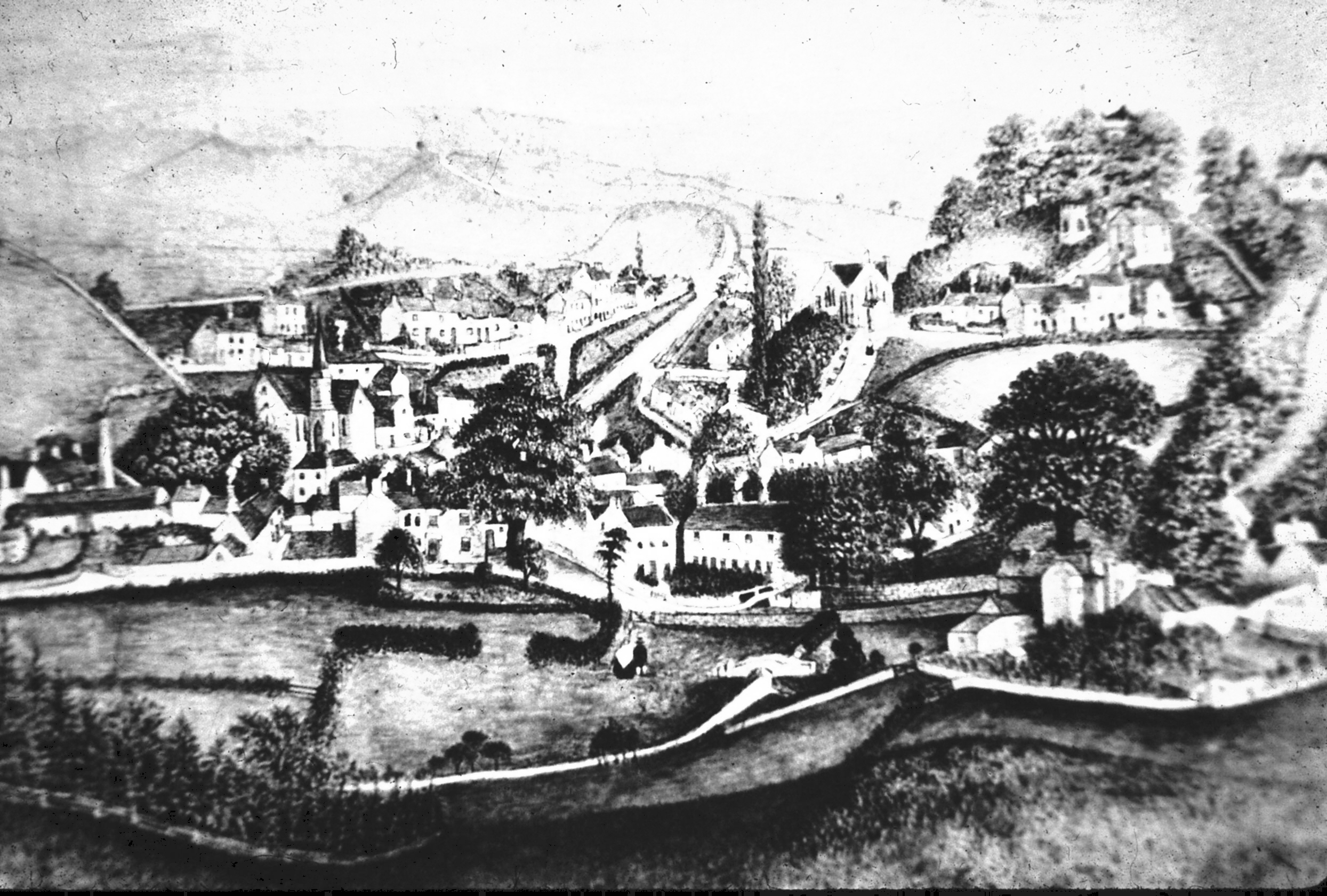
However, the land in between the established roads has since been developed; particularly since the 1960's when the Grange Estate and Duke-of-Norfolk Estates were built; and Whiston village expanded between East Bawtry Road and High Street / Moorhouse Lane a large unbroken suburban area stretching all the way from Rotherham Town Centre out to the M1 motorway - which was also constructed near Whiston in the 1960's. These maps illustrate how much the village has changed over the last 250+ years, when the village used to look like this. |
|
|
Please click on each image to view full size versions. |
|
Roman Times |
||
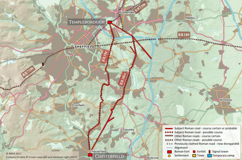
>> Roman Roads of Whiston <<When Britain was governed by the Roman Empire (approx. 43 - 410 AD) The map shows two roads heading north-east from Chesterfield; roughly following the route from Aston and past where Ulley Country Park is now situated. This is a route that the road still takes today. The Roman road then turned left in the Upper Whiston / Gulilthwaite Hill area, before continuing straight on the Templeborough - the site of the nearest (and possibly most important) Roman Fort in the area in the days when Sheffield was little more than a village. The city did not develop until the time of the industrial revolution. This is an area of interest for our Chairman - Mr Rivington - who delivered a talk on this subject at our November 2018 meeting. |
||
1700's |
||
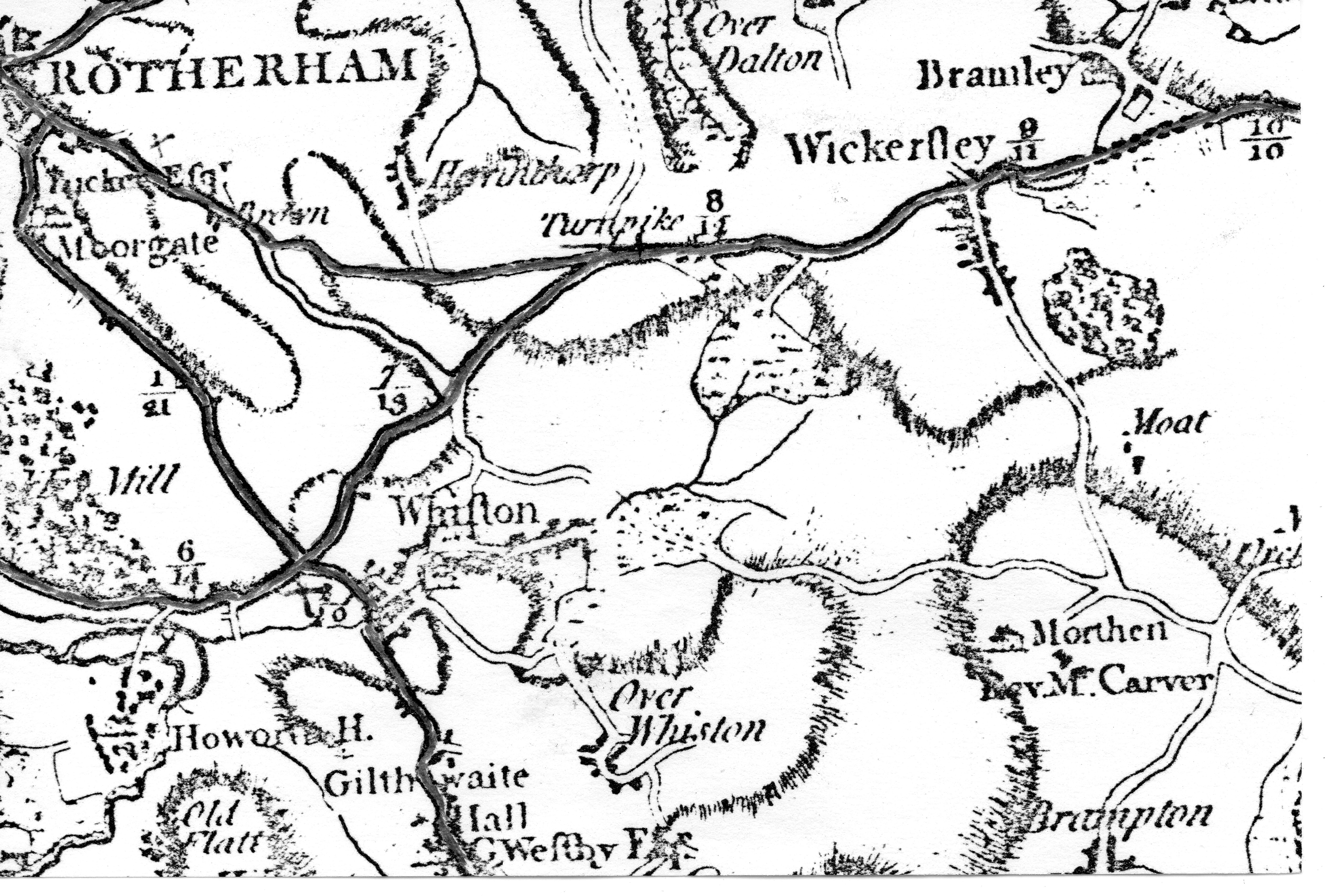
>> General Map of Whiſton - Circa 1771 <<What is most interesting about this early map is that Worrygoose Lane does not appear to be established as a major roadway yet (or at least, not drawn on the map). All of the other roads discussed above already appear to be in existence. Secondly, we are looking at a map that is old enough for the language used at the time to have changed in the 240+ years since; so 'Whiston' is spelled in two different ways, once with a small 's' ('Over Whiston' - i.e. Upper Whiston) and once with a 'long s' - ſ - (Whiſton): a letter subsequently dropped from the English Language at the start of the 19th Century - thirty or more years after this map was made. See the same thing for 'Wickerſley'. Please click on the link below to watch a short video about this linguistic change. |
||
1800's |
||
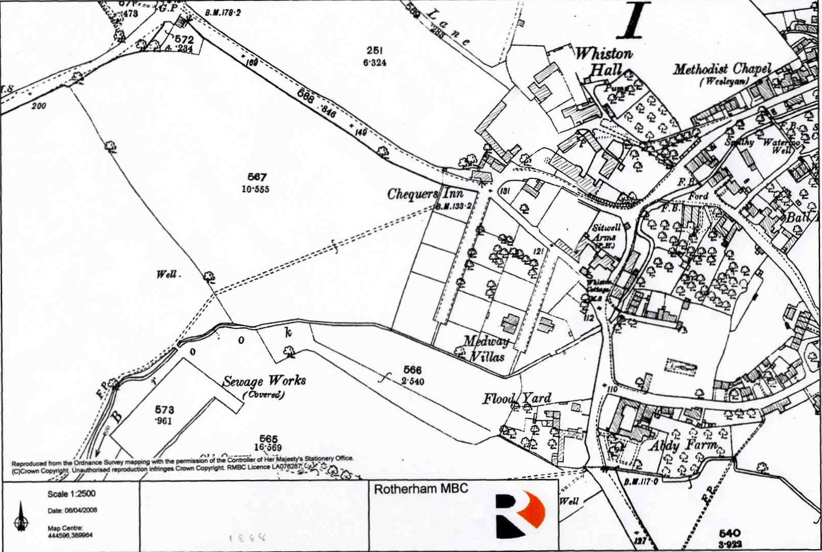
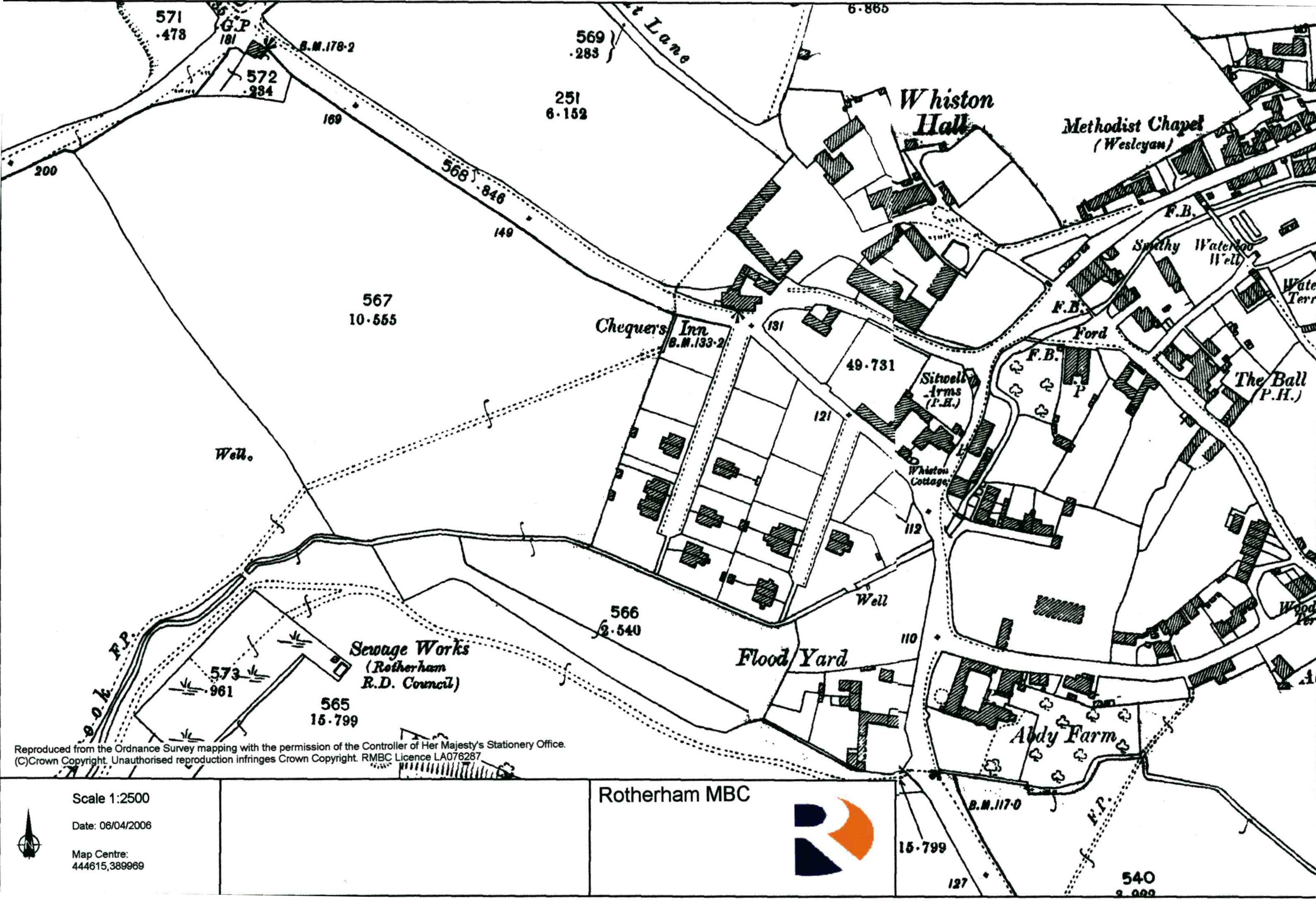
>> Circa 1888 - Western Whiston << |
>> Circa 1888 - Central Whiston << |
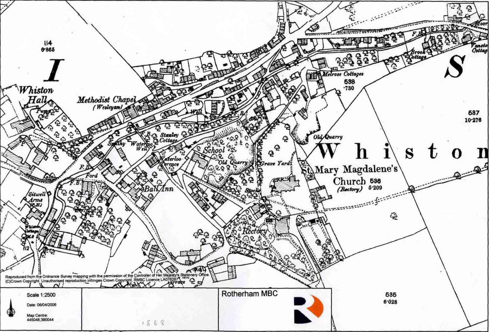
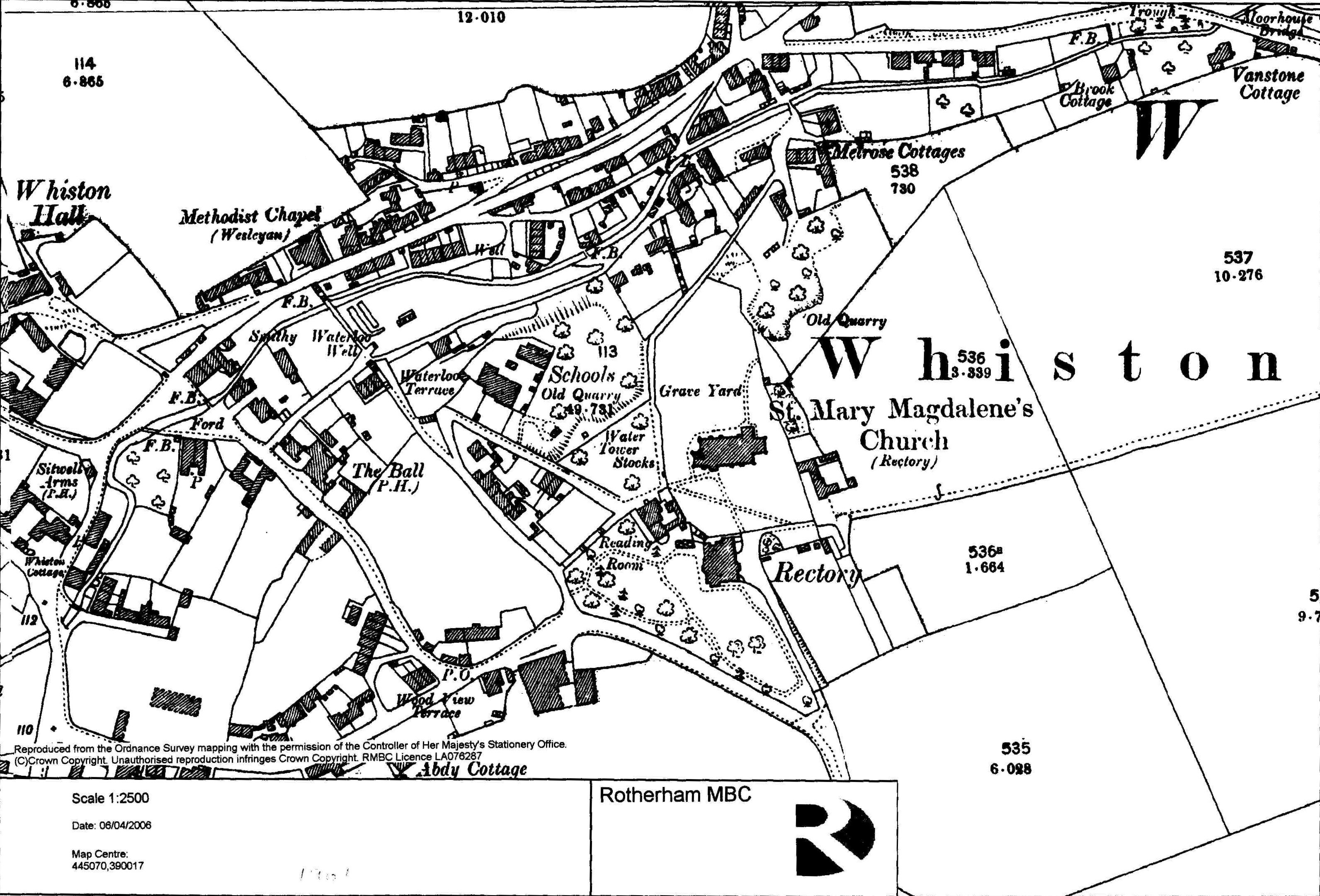
>> Circa 1888 - Eastern Whiston << |
|
Three maps of Whiston from 1888. |
||
1896 - 1903 |
||
>> Circa 1896 General Map of Whiston <<A map of the Whiston region from 1896 showing the area covered by the CofE Whiston Parish at that time. It was a large parish, streching all the way from Broom Road in the north (near where Rotherham Hospice is today); took in Herringthorpe and the Brecks to the east, Morthern to the South East; ran close to Ulley Reservoir in the south, and as far as Canklow in the west. As Rotherham gradually urbanised, the parish were redrawn: with Canklow, Herringthorpe and the Brecks being reallocated to other parishes. |
||
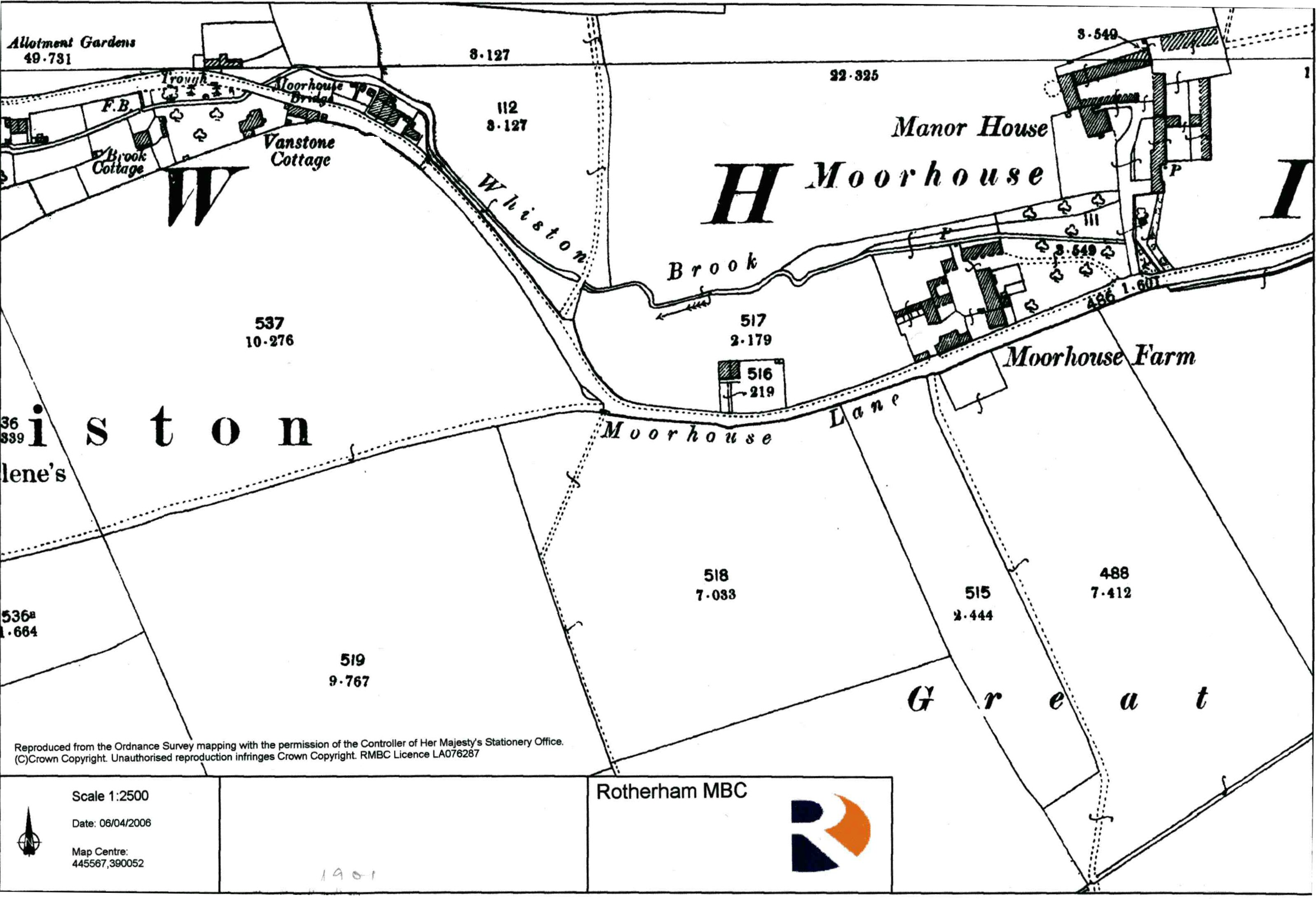
>> Circa 1901 - Western Whiston <<1901 map |
>> Circa 1901 Central Whiston << |
>> Circa 1901 - Eastern Whiston << |
|
Three maps of Whiston from 1901. |
||
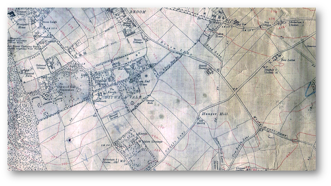
>> Circa 1903 - Sitwell House / Red House <<1903 map of sitwell house / red house - still standing; modern day Swinden Labs ('Swinden Technology Centre') / Swinden Conference House - between back of Spinneyfield and Beaconsfield Road owned by Tata Steel today. which prevented it from being knocked down. |
||
20th Century - Present Day |
||
>> 1920's Map of Whiston <<We believe this map is from the 1910’s or 1920’s. We know this from photos taken in the mid 1930’s showing Woorygoose Island roundabout under construction. Whereas this junction is not shown as a roundabout here. Moreover, there are two other interesting things about this map. The first is the absence of Herringthorpe Valley Road from Worrygoose up to the Stag. This suggests that this road appears to have been built in the mid-late 1930’s at around the same time that Worrygoose was rebuilt into a roundabout. Herringthorpe Valley Road is present in those same construction photos; which also indicates that the Stag (at the top of the map) was developed into a major junction at around the same time. Secondly, Castle Lane (in the days before it was renamed 'East Bawtry Road' and widened into a dual carriageway) does not take quite the same course as its modern counterpart. Today, the road curves gently in front of where The Hind public house is situated. However, on this map, the road kinks awkwardly one way and then the other around a small (and probably not very deep) quarry that was located in this area. |
||